SHERIDAN, WY – As the calendar turns from spring to summer this week, the weather around Wyoming isn’t, with winter weather warnings and watches in place for the northwestern part of the state and higher elevations, where anywhere from 1-4 inches of snow is expected.
The conditions and potential road hazards will make the last days of spring feel anything like the oncoming summer.
Warnings and watches are out for southern Montana, as an intense late-season snowstorm will come and go before the summer solstice arrives Friday. Wyoming won’t see much snow, but the impacts will be felt statewide Tuesday and Wednesday.
The National Weather Service has issued a Winter Weather Advisory for the Beartooth Highway from to 6 p.m. Tuesday. Up to 4 inches of snow could fall at elevations above 6,500 feet, which includes significant portions of U.S. Highway 212.
Meanwhile, it’ll be rainy and cold at Old Faithful in Yellowstone National Park, with scattered showers starting Monday and continuing through Tuesday night. Rain could transition to snow overnight and all day Tuesday, but less than an inch of accumulation is possible.
Wyomingites won’t see much snow from the solstice snowstorm, but Cowboy State Daily meteorologist Don Day said it will be cold and very un-summer-like for most of this week.
“Unless you’re in higher elevation areas, it’s going to be colder this week and pretty windy as well,” he said. “That’s going to add to the chill a bit, especially tomorrow into early Wednesday in many areas. It’ll feel like a step backward into mid-spring.”
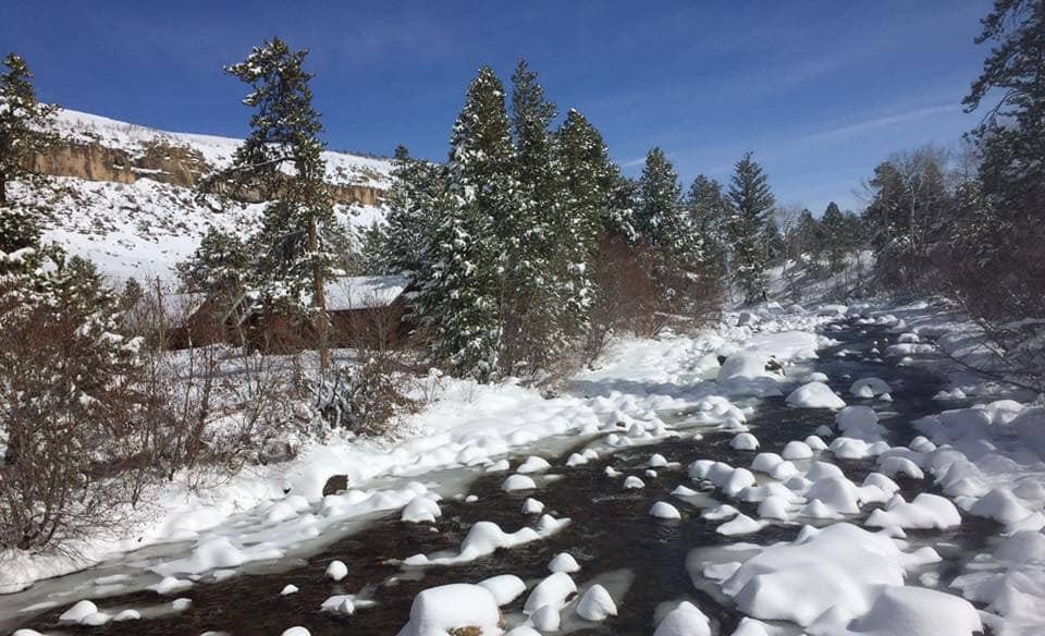
Snowy Summits
Day anticipates that high-elevation areas of northwest Wyoming will get a decent amount of snow over the next few days. The Beartooth Highway and northern parts of Yellowstone National Park will be the most susceptible to heavier snowfall.
“Yellowstone and parts of Grand Teton National Park are going to get a little bit of snow tonight into tomorrow,” he said. “It looks like the heaviest snow is going to be in the southwest mountains of Montana, around 3 to 6 inches, with the heaviest snow just north of the Montana line.”
Several inches of snow could fall on the Beartooth Highway, but that doesn’t mean it’s going to stick around. Still, Day said it will be cold enough to create road hazards that could make driving difficult.
“There’s always going to be some melting with the initial amount of snow, but since a lot of this will happen overnight into the morning, it’s going to stick,” he said.
Wet, Windy Wyoming
Elsewhere in Wyoming, there could be a dusting of snow at the highest points of the Tetons and Absarokas, and possibly some in the Wind River and Bighorn Mountains. Day said what will manifest as snow up high will become rain and strong winds below.
“The northern counties of the state are only going to be in the 50s to lower 60s (on Tuesday),” he said. “I would include the far west as well. It’s going to be downright cool in Pinedale, Jackson, Evanston, Green River and Rock Springs.”
Day cautioned that overnight temperatures could dip into the low 30s in northern Wyoming on Monday night. Big Piney and Pinedale could even see overnight temperatures in the high 20s.
Eastern and southern Wyoming won’t feel too different Tuesday, with temperatures in the 60s and 70s. However, Day said conditions of the Cowboy State will reverse between Tuesday and Wednesday.
“On Wednesday, it’ll be colder in the east while warming up in the west,” he said. “Temperatures are not going to be even statewide. Today and tomorrow, it will be coldest in the north and west and coolest in the east on Wednesday. It really depends on where you are.”
There will also be strong winds Tuesday and Wednesday, with wind gusts 20-30 mph throughout most of the Cowboy State. Tuesday will be sunny and mostly clear in eastern and southern Wyoming, then cloudy and colder Wednesday.
The NWS issued a High Wind Watch for sections of Carbon, Albany, Platte and Laramie counties for Monday night through Tuesday morning. Wind gusts of up to 58 mph or higher are possible overnight, especially at the summit of Interstate 80 between Cheyenne and Laramie.
Back To Basics
The cold snap will run its course by Wednesday night. Day anticipates Wyoming will return to “seasonal values” by the weekend.
“We’ll see temperatures warming up statewide on Thursday and as we get into Friday and the weekend,” he said. “Nothing hot, but getting back into the 70s and 80s.”
Until then, travelers should anticipate potentially hazardous conditions in the high elevations of Wyoming as the summer solstice snowstorm rolls in. Day said the Cowboy State’s photographers should also take note of the conditions, but they should see them as opportunities rather than hazards.
“There could be some pretty good photo opportunities up on Beartooth Pass, and the other higher mountain passes over the next couple of days,” he said. “It should be interesting to see what pans out.”