ABERDEEN, S.D.–Parts of the Dakotas will look wintry by Friday.
Forecasters say a weather system will drop measurable snowfall–mainly across western and north central North Dakota–from Thursday afternoon into Friday morning.
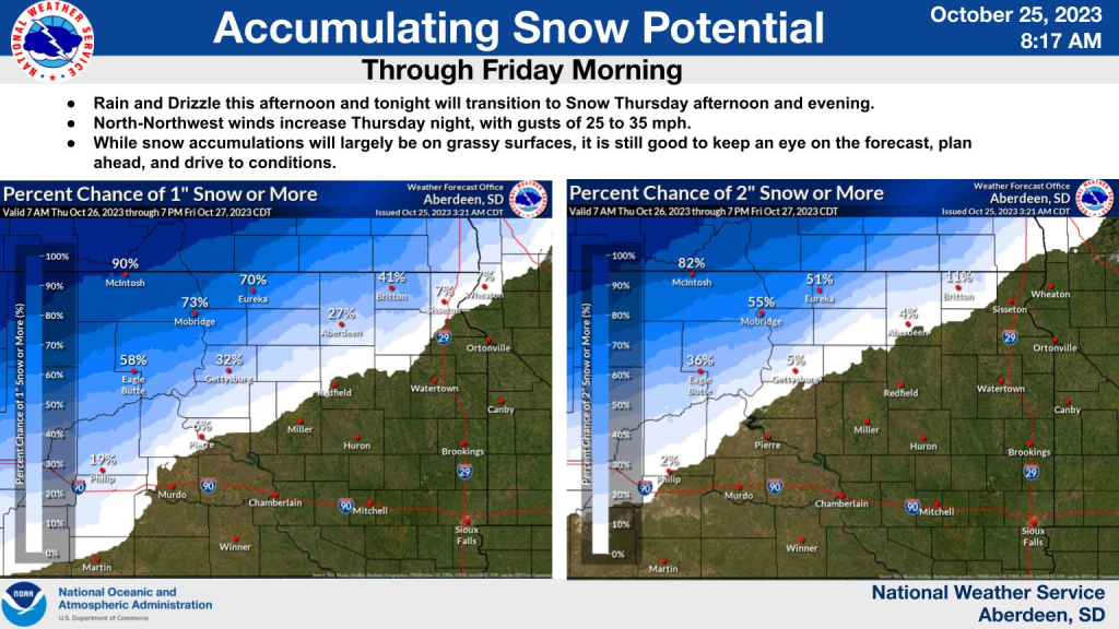
National Weather Service forecaster Megan Mulford says the snowflakes could reach down into South Dakota, mainly west of the James River valley.
“We’ll be watching this low pressure system, mainly affecting the northwestern parts of South Dakota into North Dakota. It looks like in the immediate forecast area of Aberdeen, it will be pretty lite in most places. But in northwestern parts of the state they could see anywhere from 3 to 4 inches of snow.”
Snowfall amounts won’t be extremely high, but what will be noticeable is some very chilly air that will stick around into early next week.
“We are going to be dealing with cooler than average temperatures. I think that’s going to be our main thing. We have what we call that deep trough that brings in all that cold air from the north. It’s a deeper trough than we typically see this time of year. On Friday, we’ll see temperatures highs only in the mid-30’s.
Winter Storm Warnings are posted for western and north central North Dakota, but they do NOT extend into South Dakota.